The
Danish Cyclists’ Federation (
Cyklistforbundet) throws a yearly month long event called
BIKE TO WORK (“Vi Cykler Til Arbejde” aka.
VCTA) nudging employees of Danish workplaces to use their bike for commuting. Teams are formed by the employees and team statistics are available both internally and between workplaces for the teams to compete in the number of kilometres travelled and number of active days. See f.x.
the statistics for the two teams of my employer Vestergaard. Of course my outdoor, social, competitive, and sometimes a bit extreme, mindset can’t miss such a chance to commit to an all-in full month bike relay race with myself and some distant (300 km to HQ) colleagues.
As a part of the VCTA month of cycling one day is designated to taking an unknown route to work, dubbed “Detour Wednesday” (“
Omvejsonsdag“). This is to inspire the individual to find new routes and get some fresh input on the surroundings. This year it was Wednesday September 23th, and the event even includes a draw of an electric powered bike amongst participants documenting their detour appropriately.
For your enjoyment, below are some visual impressions from my nice detour in the Tjæreborg/Bramming area (of
Western Jutland, Denmark). Even though I have been to all these places before by various different means (running, cycling, car, motorcycle), you do sense a place a lot different on the bike than by other means.
All The Maps
Being the dev/hacker/tinkerer/geo person that I am, although not extremely well-versed in HTML/javascript, I have also made a quick throw together of a visualisation on top of
Leaflet and
OpenStreetMap of the tracks I’ve recorded during VCTA.
Find it at
tools.mikini.dk/vcta, and source code at
gitlab.com/mikini/vcta.
Out

In front of Sneum Sluse, where Sneum Å joins the sea. Location: 55.43321;8.60780

Along the dyke between Sneum Sluse and Darum. Approximate location: 55.42917;8.62244
Home

Crossing Sneum Å again, this time in-land approximately 12 km upstream from Sneum Sluse. Location: 55.49637;8.69648
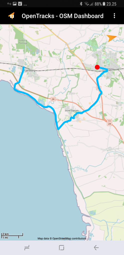
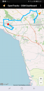
Tracks
The tracks as recorded by Endomondo;
The tracks as recorded by OpenTracks (Application: F-Droid, Github, Google Play, OSM Dashboard: F-Droid, Github, Google Play).
Outgoing track as recorded by OpenTracks.
Homegoing track as recorded by OpenTracks.